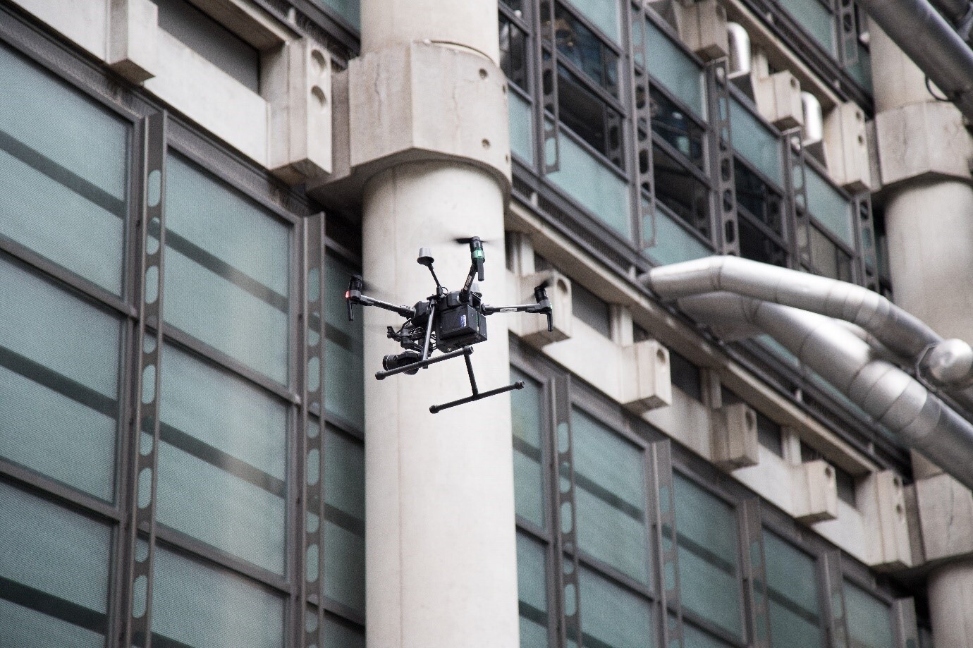
Why use Drone Technology
Capabilities of Drones in Construction
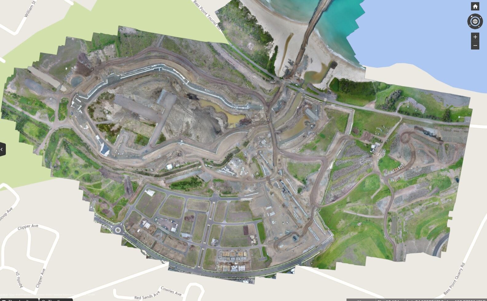
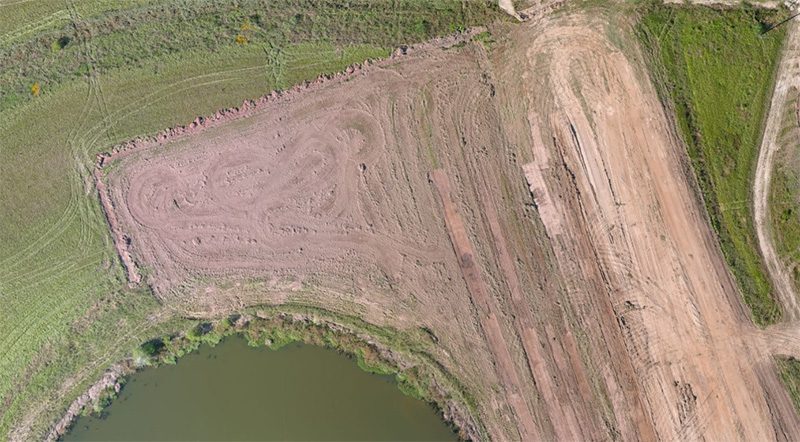
🗺️ Aerial Surveying and Mapping
- Drones provide high-resolution aerial images that can be used for topographic surveys, site planning, and mapping. They offer a faster and more cost-effective solution than traditional methods, with the ability to cover large areas in a short amount of time.
📊 Monitoring Construction Progress
- UAV technology enables real-time monitoring of construction sites, allowing project managers to track progress, manage resources more efficiently, and make informed decisions. Time-lapse photography and video can document the evolution of a project from start to finish.
🔍 Inspection and Quality Control
- Drones can access hard-to-reach areas, such as high roofs, bridges, and towers, to conduct inspections safely and efficiently. They can detect issues like structural weaknesses, water damage, and other defects without the need for scaffolding or cranes.
🛡️ Safety Enhancements
- By using drones for inspections and site surveys, the need for workers to access dangerous or difficult-to-reach areas is significantly reduced, thereby enhancing on-site safety.
📢 Improved Communication and Collaboration
- Aerial imagery and data collected by drones can be shared easily among project stakeholders, improving communication and collaboration. This visual documentation can help in resolving disputes and validating work completed.
Benefits of Utilizing Drones
- Cost Savings:
Reduced need for manual labor and traditional surveying equipment. - Time Efficiency:
Quicker data collection and analysis leads to faster decision-making. - Accuracy and Precision:
High-quality imagery and data improve the accuracy of surveys and inspections. - Enhanced Safety:
Minimizes the risk to personnel by limiting the need for physical access to hazardous areas. - Better Project Outcomes:
Comprehensive site data contributes to more informed planning and execution, resulting in higher quality projects.
Maximizing Drone Data
Key Data Points to Capture
 | Topographic Insights: Elevations and landforms for meticulous planning. |
 | Structural Health: Pinpoint potential maintenance areas without the need for risky manual inspections. |
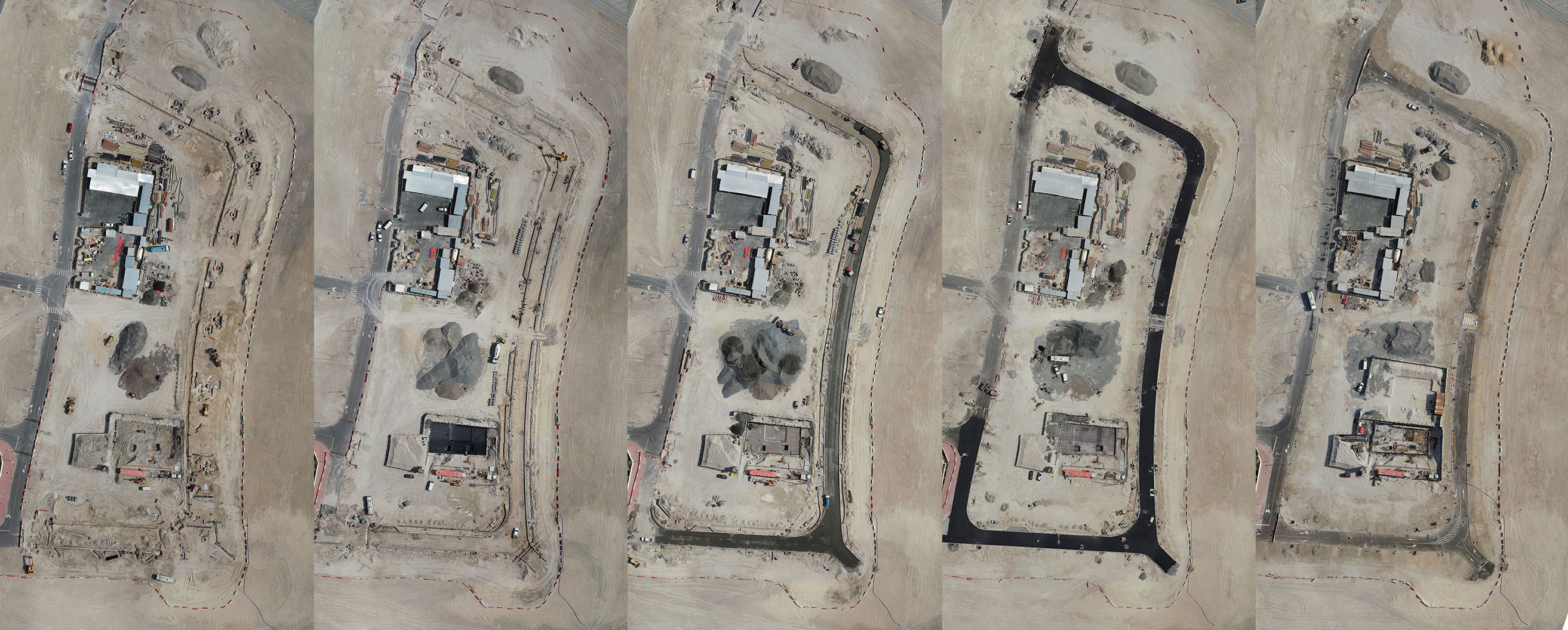 | Progress Tracking: Visual timelines that illustrate phase completions and overall project evolution. |
 | Environmental Monitoring: |
Legal Considerations
Regulatory Compliance
- Operators must comply with national and local regulations governing drone flights, which may include obtaining necessary licenses or permits.
- In the U.S., the Federal Aviation Administration (FAA) sets rules for commercial drone use, including Part 107 regulations.
Privacy Laws
- Be aware of privacy issues when flying drones over private property or near sensitive areas. Adhering to privacy laws and respecting individuals’ privacy rights is essential.
Airspace Restrictions
- Check for any airspace restrictions that might affect drone operations, especially near airports or in controlled airspace. Use of apps and tools like B4UFLY can help identify restricted areas.
Insurance Requirements
- Ensure adequate insurance coverage for drone operations, covering potential liabilities for accidents, injuries, or damage to third parties.
Safety Considerations
Pre-flight Planning
- Conduct thorough pre-flight checks and risk assessments for each flight, considering weather conditions, equipment status, and potential hazards on site.
Pilot Training and Certification
- Pilots should receive proper training and, where required, certification to operate drones safely and effectively.
Maintaining Visual Line of Sight
- Keep the drone within visual line of sight at all times to monitor its flight path and avoid obstacles.
Emergency Procedures
- Establish clear procedures for handling emergencies, including communication protocols and steps for safely aborting flights.
Data Security
- Protect the data collected by drones from unauthorized access or breaches, particularly when it includes sensitive or proprietary information.
